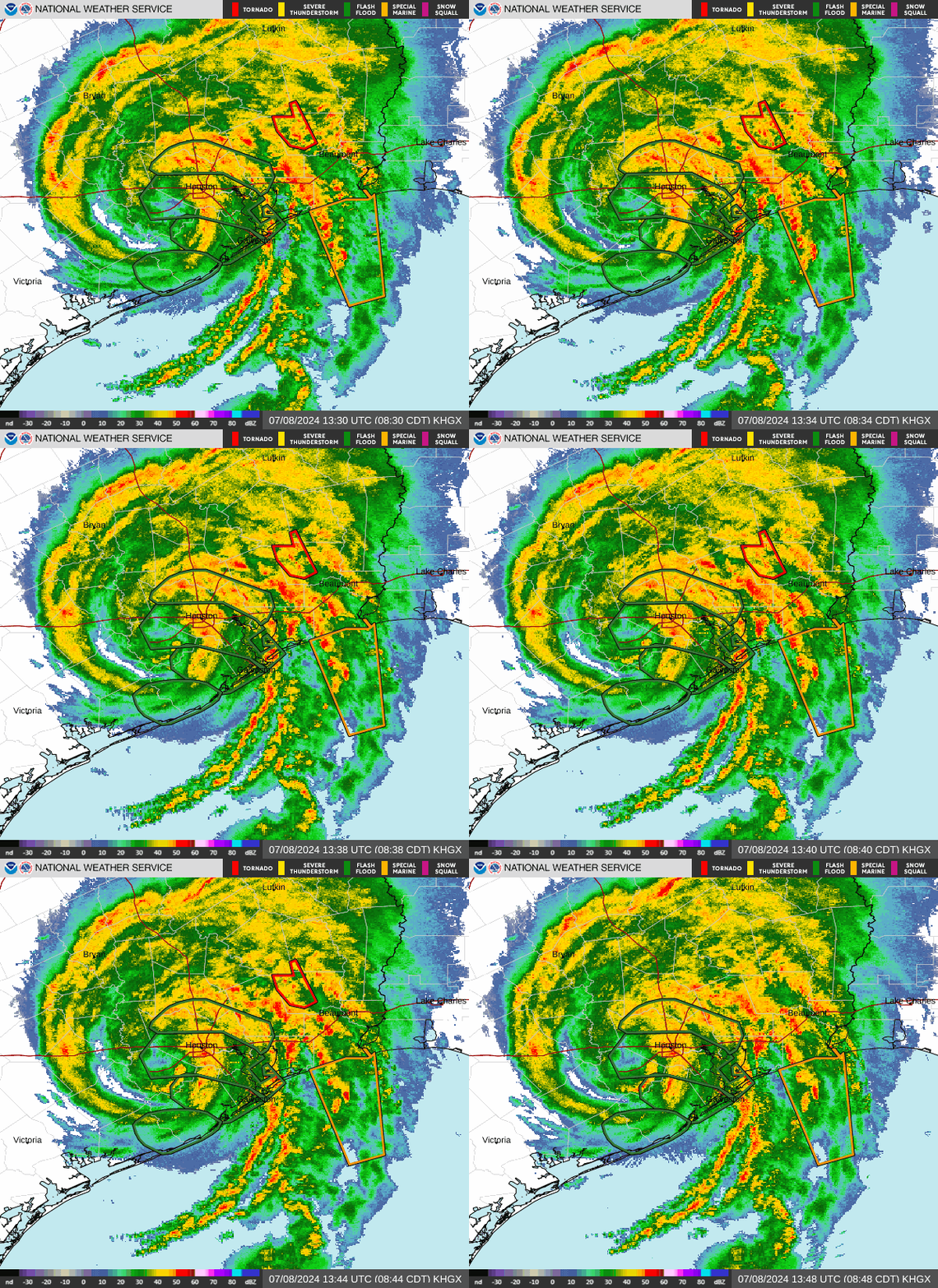
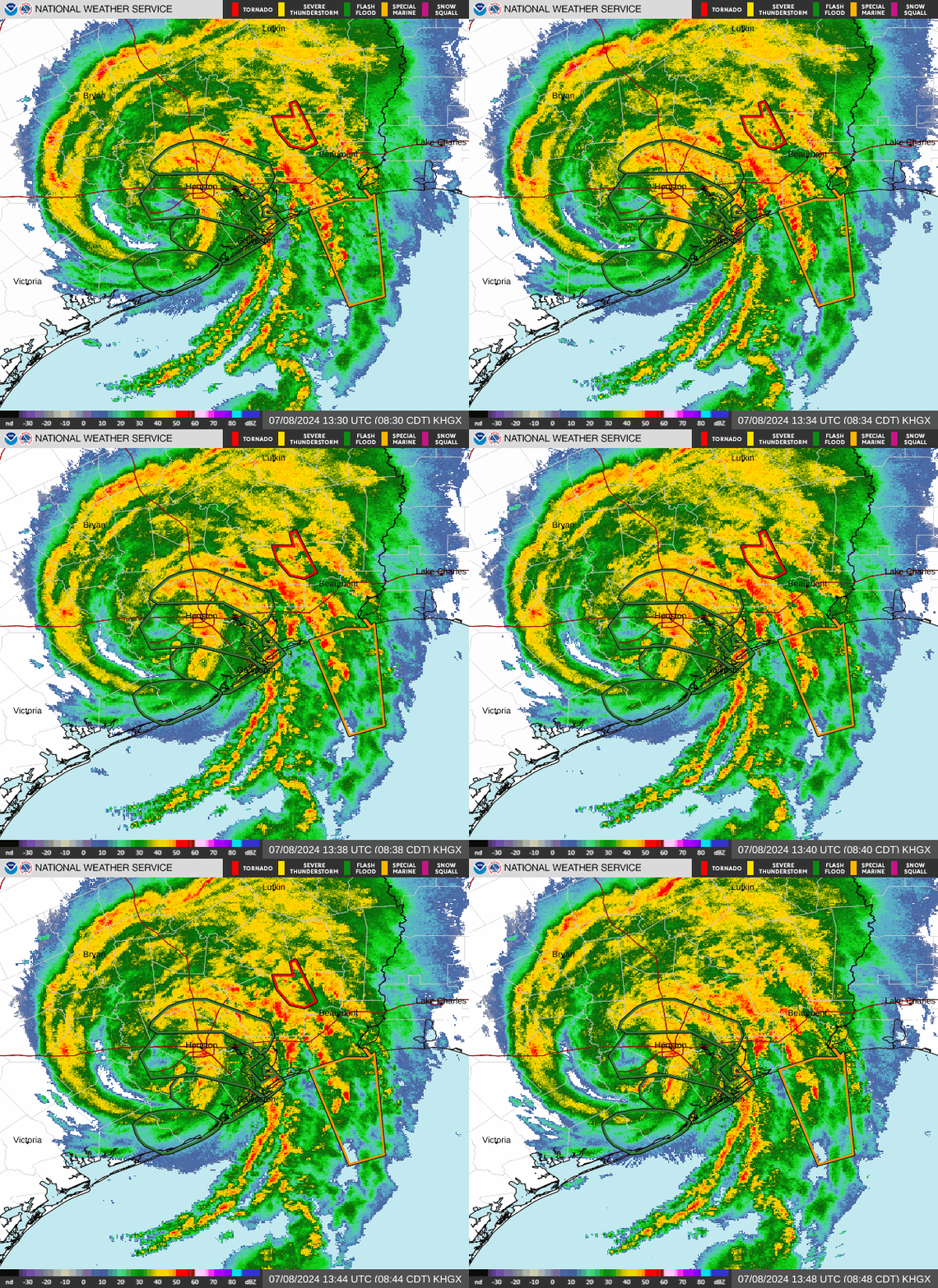
Hurricane Beryl already has a lot of firsts, seconds and thirds:
Acting Gov. Dan Patrick added Travis County, the county Austin is in, to the state’s Hurricane Beryl Disaster Declaration on July 6, along with 80 other counties, cautioning Texans of possible flooding.
“Do not ignore this storm,” Patrick said in a statement.
Here’s what we know about Beryl, its landfall in Matagorda, Texas, and its impacts on the Lone Star State.
Track Hurricane Beryl: See latest radar images as Beryl moves into Texas

Map: Driving conditions, road closures in Texas
Houston traffic cameras
Tips for driving in heavy rain, strong winds and flood conditions
Texas Department of Insurance urges drivers to be careful when driving in poor weather conditions. Here are some tips from them.
-
Avoid puddles: Driving into puddles or low-lying areas where rainwater collects, such as dips under rail or highway bridges or near streams, can cause vehicles to hydroplane out of control.
-
Drive in the middle lanes: Staying on higher ground is a good safety measure, especially during heavy rains. Rainwater often pools on the outer edges of roads, which can create hazardous driving conditions, including hydroplaning. It’s always best to drive with caution and avoid flooded areas whenever possible.
-
Keep headlights on: Using your vehicle’s headlights in the rain, even during daylight, is a crucial safety measure. It enhances your visibility to other drivers and improves your ability to see the road ahead. This practice can significantly reduce the risk of accidents in rainy conditions.
-
Use turn signals early: Giving plenty of notice to other drivers before slowing down to take a turn is essential for road safety. Signaling early and clearly allows other drivers to anticipate your actions and adjust their driving accordingly, reducing the risk of collisions.
-
Don’t slam the breaks: In bad weather, it’s important to brake safely. Remove your foot from the accelerator and apply the brakes lightly to stop. Always keep an eye out for brake lights ahead to anticipate any sudden stops or slowdowns by other drivers. This cautious approach helps maintain control of your vehicle and reduces the risk of skidding or losing traction.
-
Avoid sharp turns: Quick driving maneuvers can lead to skids and accidents.
On Monday, July 8, Beryl made landfall as a Category 1 hurricane about 4:30 a.m. near Matagorda, Texas, a coastal community between Corpus Christi and Galveston. Matagorda is about 200 miles away from Austin. The storm previously made landfall in Grenada and Mexico the week heading into the Fourth of July holiday (see below).
Where is Matagorda, Texas?
Matagorda, Texas, is located on the Gulf coast, about 80 miles southwest of Houston and nearly 200 miles southeast of Austin.
From Invest 95L to Beryl: As we track Beryl’s path, here’s a look back at the tropical storm that strengthened into a hurricane and made landfall three times in less than two weeks.
Hurricane season runs June 1 to Nov. 30, with the busiest part of the season between August and October.
-
On Friday, June 28, 2024, the National Hurricane Center in Miami issued advisories on “Invest 95L.” At 11 p.m. June 28, the tropical cyclone became Tropical Storm Beryl.
-
On Saturday, June 29, the National Hurricane Center reported Beryl strengthened into hurricane status by 5 p.m.
-
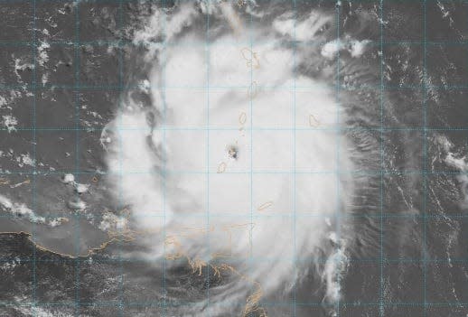
On Monday, July 1, Beryl was a powerful Category 4 hurricane that hit Carriacou Island, Grenada, with 150-mph winds. The photo below by the National Oceanic and Atmospheric Administration shows Beryl at landfall days ahead of the Fourth of July holiday.

-
On Tuesday, July 2, Hurricane Beryl strengthened into a Category 5 storm with 165 mph winds.
-
On Friday, July 5, Beryl weakened into a tropical storm, but made landfall near Tulum, Mexico, on the Yucatan Peninsula as a Category 2 storm, according to the National Hurricane Center. That was Beryl’s second landfall in a week. By then, the storm was moving ashore as a Category 2 with 110-mph winds.
-
On Saturday, July 6, Tropical Storm Beryl was projected to become a hurricane when it makes landfall (potentially the storm’s third) in northeastern Mexico or southern Texas late Sunday into Monday, according to the National Hurricane Center.
-
On Sunday, July 7, Tropical Storm Beryl was expected to strengthen into a hurricane and make landfall on the coast of Texas on Monday morning.
-
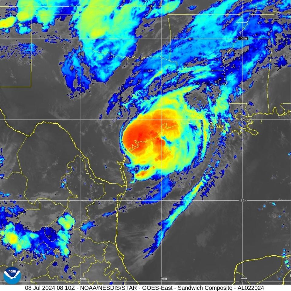
On Monday, July 8, Beryl made landfall as a Category 1 hurricane about 4:30 a.m. near Matagorda, Texas, a coastal community between Corpus Christi and Galveston. The storm previously made landfall in Grenada and Mexico the week heading into the Fourth of July holiday. The satellite image below from NOAA shows Beryl at landfall.

Coincidentally, Tropical Storm Alberto, the first named storm of the 2024 Atlantic hurricane season, made landfall over Mexico about 7 a.m. CDT Thursday, June 20, 2024, according to the National Hurricane Center in Miami. Landfall was recorded about 25 miles west of Tampico, Mexico, and about 255 miles south of Brownsville, Texas. Beryl made landfall in Grenada, Mexico and Texas.
Photos of Hurricane Beryl after its landfall in Matagorda, Texas
Eye of Hurricane Beryl through graphics and satellite images
The photo gallery below contains graphics and satellite images of Beryl, from Invest 95L to tropical storm and hurricane, from NOAA, the National Hurricane Center and AccuWeather.
This article originally appeared on Florida Today: Hurricane Beryl photos, damage, forecast, latest storm track
EMEA Tribune is not involved in this news article, it is taken from our partners and or from the News Agencies. Copyright and Credit go to the News Agencies, email news@emeatribune.com Follow our WhatsApp verified Channel


