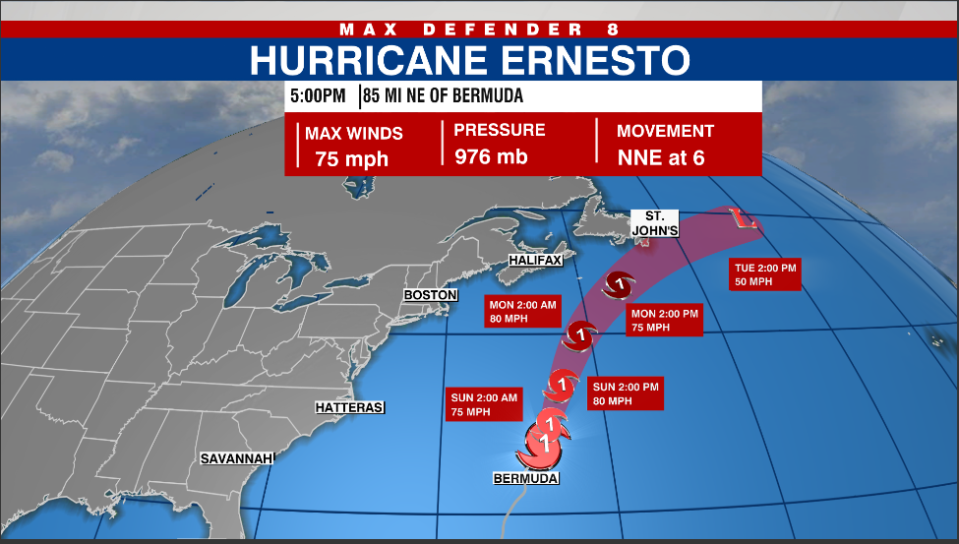
TAMPA, Fla. (WFLA) — Hurricane Ernesto made landfall early Saturday morning in Bermuda, bringing heavy rainfall and strong winds to the island.
The National Hurricane Center said the category 1 hurricane hit the western side of Bermuda around 3:30 a.m.
Nearly 400 gallons of high-expansion foam fills Coast Guard hangar in Mobile
In a 5 p.m. update, the cyclone had maximum sustained winds of 75 mph. Officials expect strong winds, storm surges, and life-threatening flooding into Saturday evening.
“Hurricane Ernesto continues to move away from Bermuda as conditions will improve tonight over the island,” Max Defender 8 Meteorologist Eric Stone said. “Ernesto will continue to move north-northeast and produce high surf to the mid-Atlantic and northeast beaches the next couple days. Ernesto will weaken to a tropical storm and become extra tropical early next week as it moves close to St. Johns.”

Ernesto is continuing on a north-northeastward track, with a possibility of re-intensification, and is expected to move near or east of Newfoundland by Monday night.
Watch Tracking the Tropics on Tuesdays at 12:30 p.m. ET/11:30 a.m. CT.
Be prepared with the 2024 Hurricane Guide and stay ahead of tropical development with the Tracking the Tropics newsletter.
Copyright 2024 Nexstar Media, Inc. All rights reserved. This material may not be published, broadcast, rewritten, or redistributed.
For the latest news, weather, sports, and streaming video, head to WFLA.
EMEA Tribune is not involved in this news article, it is taken from our partners and or from the News Agencies. Copyright and Credit go to the News Agencies, email news@emeatribune.com Follow our WhatsApp verified Channel


