An Arctic blast has brought snow, frost and dangerously cold winds to the northern Plains, Midwest and Great Lakes, creating “very difficult to impossible” travel conditions on one of the busiest days of the year, as millions of Americans head home from their Thanksgiving destinations.
Approximately 7 million people are under winter alerts across Wisconsin, Michigan, Ohio, Pennsylvania and New York, with some alerts expected to continue into Tuesday morning.
A National Weather Service advisory warned Sunday that travel-thwarting lake effect snow bands and showers had developed downwind of the Great Lakes in northeast Ohio, far northwest Pennsylvania, western New York and portions of northwest New York.
Advertisement
Advertisement
Gov. Kathy Hochul on Saturday warned New Yorkers to avoid unnecessary travel. More than 100 National Guard troops were staged in western New York “to support local communities,” she said in a statement.

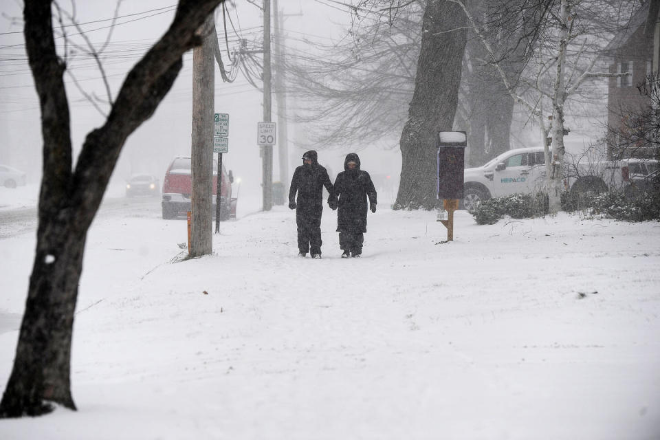
A couple makes their way through lake effect snow in Hamburg, N.Y., on Nov. 30.
Interstate 90 in western New York reopened to passenger vehicles Saturday afternoon after it was closed on Friday, Hochul announced, adding that commercial trucks were still banned in both directions along the westernmost portion of the interstate starting at Exit 46.
The highest snow accumulations are expected east of Lake Ontario, where some isolated areas could be hit by up to 60 inches of lake effect snow by early next week around the Watertown, New York, area, the NWS said. The Tug Hill Plateau will be hit especially hard, with an additional 1 to 3 feet of snow expected there through Tuesday morning.
In the Buffalo–Niagara Falls Metropolitan area, Orchard Park may receive anywhere from 8 to 20 inches of snow before Tuesday morning. The weather service office in Cheektowaga, New York, which covers Buffalo, said Saturday that bands of lake effect snow would be active in the Southtowns of Buffalo overnight, with 2 feet of snow and “extremely hazardous travel” possible.
Advertisement
Advertisement
Erie, Pennsylvania, has recorded 30 inches of snow, the highest total so far, according to the agency. Federal forecasters said as much as 6 feet of snow could cake the ground in northern Erie County, Pennsylvania, by Tuesday. An additional 10 to 20 inches of snow can be expected in the city.

Drivers move slowly on a snow-covered Grandview Boulevard in Erie, Pa., on Nov. 29.
The weather service office in Cleveland said Saturday that more than a foot of lake effect snow was possible in parts of the region starting at noon Sunday and continuing through 7 a.m. Tuesday, impacting travel between Cleveland and Buffalo.
An additional 2 to 10 inches of snow will be possible through Monday, impacting cities like Traverse City, Marquette and Ironwood in Michigan, and Milwaukee in Wisconsin.
Parts of eastern Kentucky and West Virginia remain under winter alerts Sunday morning as scattered snow showers persist, according to the weather service. Charleston and Jackson, Kentucky, are included in these alerts through the afternoon, with an additional 1 to 2 inches of snow possible.
Advertisement
Advertisement
More in U.S.
Freeze alerts are in place for around 2 million people through Sunday night for parts of southeast Georgia and north Florida, including Lake City and Gainesville, Florida, where overnight lows will dip into the upper 20s and low 30s.
Temperatures from the Northern Plains through the Midwest and East Coast will remain 10 to 20 degrees below average Sunday afternoon. Highs in the Dakotas will reach single digits, while the Midwest will stay in the 20s and 30s. In the Mid-Atlantic and Northeast, highs will range from the 30s and 40s.
Temperatures across the central and eastern U.S. will generally stay at or below freezing through the upcoming week.

Grounds crew members shovel snow off the yard lines at Huntington Bank Field Stadium in Cleveland, Ohio, on Nov. 21.
Earlier in November, the Transportation Security Administration projected that Sunday would be one of the three busiest travel days of the year.
Advertisement
Advertisement
More than 17 million people were under National Weather Service winter alerts Saturday, including 3.6 million under lake effect snow warnings, 4.5 million under freeze warnings, 8.5 million under winter weather advisories and 1 million under frost advisories.
The weather service says lake effect snow is produced when a cold air mass moves south from Canada and beyond over the comparatively warm Great Lakes, pulling some of the lake water quickly into the atmosphere, forming fertile clouds and generating snow at a rate of 2 to 3 inches or more each hour.
Its effects are expected to taper off early next week, but weather forecasters warned that colder air was still headed south, with an Arctic air mass spilling south out of Canada.
This article was originally published on NBCNews.com
EMEA Tribune is not involved in this news article, it is taken from our partners and or from the News Agencies. Copyright and Credit go to the News Agencies, email news@emeatribune.com Follow our WhatsApp verified Channel


