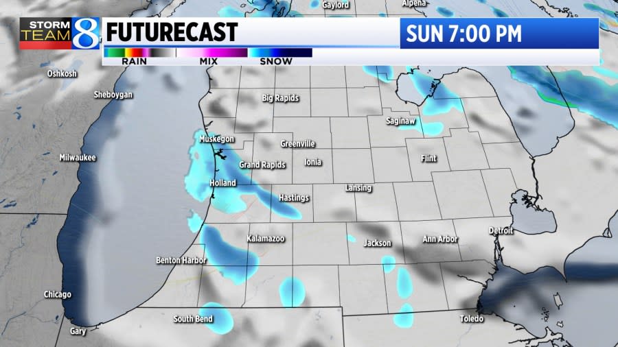
GRAND RAPIDS, Mich. (WOOD) — Another round of lake-effect snow is likely Sunday into Monday, with significant totals possible in a few communities.
Light flurries are expected overnight into early Sunday, with little accumulation expected. Lake-effect is expected to gradually intensify through the afternoon, with bands primarily impacting areas south and west of Grand Rapids.
Sign up for the Storm Team 8 daily forecast newsletter

While travel impacts will be light during the day Sunday with highs nearing 30, slick roads are likely where snow continues to fall after dark.
Advertisement
Advertisement
The placement of lake-effect bands Sunday night into Monday is hard to forecast with much certainty. While it’s likely to be south and west of Grand Rapids, there will likely be sharp cutoffs. Heavy snowfall rates will be possible under those bands.

As winds shift slightly northerly into the day Monday, the heaviest lake-effect may migrate closer to the lakeshore. Still, heavy snowfall rates will be possible there at times through the day.

The snowfall forecast for this event is tricky as well, because of lingering uncertainty with regard to the placement of heaviest lake-effect bands. Still, that is most likely south and west of Grand Rapids. Between US-31 and US-131, 2 or more inches of fresh snow is likely by late Monday.
Advertisement
Advertisement

Snow chances are set to continue on and off through the rest of the week, and could be significant at times. Stay with Storm Team 8 for the latest forecast.
Copyright 2024 Nexstar Media, Inc. All rights reserved. This material may not be published, broadcast, rewritten, or redistributed.
For the latest news, weather, sports, and streaming video, head to WOODTV.com.
EMEA Tribune is not involved in this news article, it is taken from our partners and or from the News Agencies. Copyright and Credit go to the News Agencies, email news@emeatribune.com Follow our WhatsApp verified Channel


