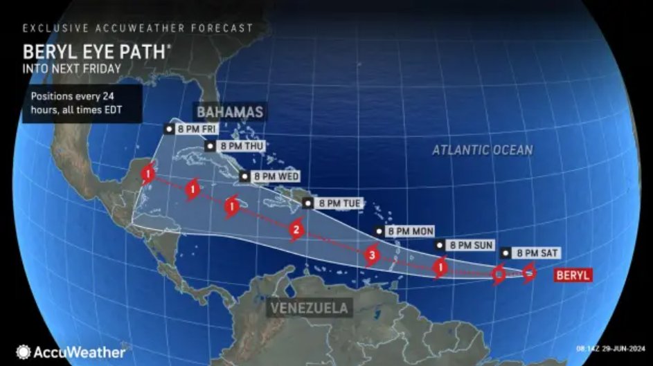
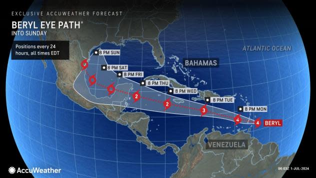
After making landfall Monday morning as a powerful Category 4 storm, Hurricane Beryl is now making its way across the Caribbean Sea.
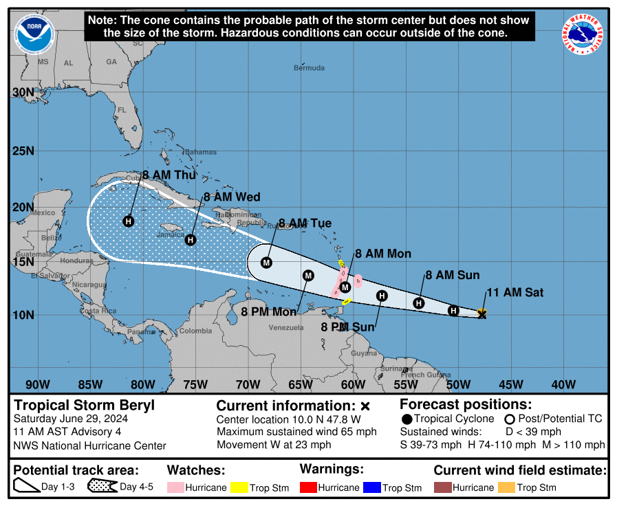
The official National Hurricane Center forecast predicts Beryl will mover over the Yucatan Peninsula Thursday night and enter the southwestern Gulf of Mexico Friday.
➤ Spaghetti models for Hurricane Beryl
Although larger than it was last week, Hurricane Beryl remains a fairly compact storm, with hurricane-force winds extending outward up to 40 miles from the center and tropical-storm-force winds extending outward up to 125 miles, according to Monday’s 2 p.m. advisory.
That said, could Beryl affect your Fourth of July plans or even activities planned for the weekend? Here’s what you should know.
Current forecast for Hurricane Beryl

Latest spaghetti models for Hurricane Beryl. Will it approach Florida?
Can’t see the map? Open in a new browser.
Special note about spaghetti models: Spaghetti model illustrations include an array of forecast tools and models, and not all are created equal. The hurricane center uses only the top four or five highest performing models to help make its forecasts.
What impact could Hurricane Beryl have on Florida?
Over the next couple of days, expect Beryl to head northwest across the Caribbean, giving Jamaica a close shave as it passes by, said AccuWeather Lead Hurricane Forecaster Alex DaSilva.
It should be just east of the Yucatan Peninsula on the Fourth of July and shouldn’t be an issue for holiday plans for the United States.
In Florida, any thunderstorms would be normal storms associated with sea breezes unrelated to Beryl.
If Beryl is a weaker storm by the time it enters the Bay of Campeche, it’s expected to continuing moving west into Mexico. “Weaker storms, their thunderstorms don’t extend as far into the atmosphere. They’re controlled by lower-level winds, which mostly run east to west,” DaSilva said.
However, if Beryl is still a hurricane at that point or even a strong tropical storm, and the system of high pressure over the southern U.S. weakens and slides to the east as expected, that could leave a channel for Beryl to move toward the north, DaSvila said.
In that scenario, Beryl could have an impact on Texas or even western Louisiana.
“Right now the offiical forecast takes it into northern Mexico. We have many days to watch this. If it can hold together, I’d be worried about direct impact on US by end of the weekend, Sunday into Monday,” DaSilva said.
Rip currents and increased surf could be felt along West Florida coasts, even if Beryl heads west into Mexico. Rain bands, though, probably won’t make it to Florida.
Timeline: Where could Hurricane Beryl go? When will it strengthen?

Where Hurricane Beryl goes after it moves through the Caribbean depend on a couple of factors: land interaction and a system of high pressure over the southeastern United States, DaSilva said.
If it moves over Hispaniola or eastern Cuba, the land and mountains could disrupt its circulation, leading to less organization and weakening from a wind speed perspective. That doesn’t mean those areas wouldn’t feel an impact from the storm, which could dump a huge amount of rain on the islands, DaSilva said.
“We’re going to have to watch an area of high pressure across the southeastern U.S. If there is weakness in that high-pressure system, (Beryl) could be drawn up north into either the Gulf of Mexico or the Florida Peninsula,” DaSilva said.
For this reason, AccuWeather meteorologists have included South Texas in the potential “window of movement,” with some risk to lives and property in the region.
Timing would be next weekend if it does get drawn north, so really watch this thing July 5-7, DaSilva said.
If the system of high pressure stays strong, the storm will be forced west and go into Yucatan and Mexico, with no real impacts to the U.S.
Will Florida feel any impact from Beryl on Fourth of July?

The official National Hurricane Center forecast is for Beryl to move over the Yucatan late on the Fourth of July and into the Bay of Campeche and southwestern Gulf of Mexico Friday.
The National Weather Service in Mobile said there is a low risk for rip currents for the Fourth of July, but risks pick up Friday and into the weekend due to swells from Beryl reaching local beaches.
“Right there is still too much uncertainty whether Beryl would just continue chugging along to the west-northwest into Mexico or start to take a turn to the northwest-north-northwest,” the National Weather Service New Orleans said.
The National Weather Service Houston agreed with the uncertainties present at this time.
“What will Beryl look like after moving across land? What will the shear profile look like? What is the ridging situation and steering flow locally? Etc, etc. So really not a lot to be alarmed about at the moment … but just keep an eye on things as the week progresses,” Houston forecasters said.
Farther south, the National Weather Service in Brownsville, Texas, was a little more cautious.
“All eyes remain on Hurricane Beryl, potentially somewhere into the Gulf of Mexico next weekend. This could increase winds, seas, and rain chances by Saturday.”
This article originally appeared on Treasure Coast Newspapers: Hurricane Beryl Florida impact, and what about July 4th?
EMEA Tribune is not involved in this news article, it is taken from our partners and or from the News Agencies. Copyright and Credit go to the News Agencies, email news@emeatribune.com Follow our WhatsApp verified Channel


