The Met Office has warned that more snow is expected to hit parts of the UK throughout the week
On Tuesday more weather warnings were issued for parts of England, Wales, Northern Ireland, and Scotlad as the cold Arctic blast continues to sweep across the nation.
And snow is expected to continue right up to the weekend, according to the latest Met Office weather maps. Currently (as of Tuesday afternoon) the weather radar for Saturday at around 9am shows a 135-mile band of snow from Northumbria to Stoke, covering a huge area of England.
READ MORE: Met Office issues three more UK snow warnings as Arctic blast continues
It also shows large areas of snow showers covering north Wales, southern Scotland, and Northern Ireland. The snow showers are then expected to be replaced by rain as the day goes on.
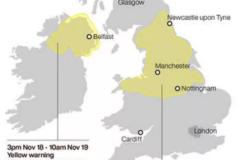
However, the UK can expect more snow ahead of the weekend after the Met Office issued three new weather warnings on Tuesday.
A yellow warning for snow and ice along the east coast of Scotland and England from Berwickshire to Suffolk is in place from 6pm on Tuesday to midday on Wednesday.
A yellow warning for snow and ice covering Northern Ireland has been issued from 6 p.m. on Tuesday to 10 a.m. on Wednesday. Warnings also cover the north of Scotland until 10 a.m. on Wednesday and much of central and South Wales until 11.59 p.m. on Tuesday.
A separate warning for much of central and north Wales is in place from midnight until midday on Wednesday.
Met Office Chief Meteorologist Neil Armstrong said: “With cold Arctic air firmly in place over the UK, continued winter hazards are likely through much of this week, with further updates to warnings likely in the coming days.

“The current focus for upcoming snow and ice risk is from later on Tuesday and overnight into Wednesday, with snow showers likely moving in off windward coasts in the north and east, as well as drifting into parts of Northern Ireland and Wales.
“In excess of 10cm of snow is possible over higher ground within the warning areas, with 1-2cm possibly settling at lower levels, which has the potential to lead to some travel disruption. Ice is an additional hazard and is likely to form quickly on untreated surfaces.”
Monday night saw sub-zero temperatures for much of the UK, reaching as low as -11.2C at Braemar in Aberdeenshire.
Snowfall was also widely reported, with 12cm of lying snow recorded at Watnall, Nottinghamshire on Tuesday morning as an Arctic airmass influenced the UK’s weather.
Thousands of train passengers suffered disruption due to the weather on Tuesday morning.
EMEA Tribune is not involved in this news article, it is taken from our partners and or from the News Agencies. Copyright and Credit go to the News Agencies, email news@emeatribune.com Follow our WhatsApp verified Channel


