Beryl has finally come close to the end of its life, which started June 28 in the Atlantic Ocean.
That doesn’t mean it won’t continue to impact portion of the United States until it’s last gasp.
After making landfall Monday morning at Matagorda, Texas, as a Category 1 storm with 80-mph winds, Beryl left more than 2.7 million homes and business without power. At least four people were killed as Beryl flooded highways and closed oil ports.
➤ Track Tropical Depression Beryl
➤ Live updates: Get the latest on Beryl after its Texas landfall. Death toll climbing
Beryl weakened into a tropical depression overnight, but it’s expected to bring heavy rainfall and possibly flash flooding from the lower and mis Mississippi Valle to the Great Lakes today and Wednesday, according to the latest advisory from the National Hurricane Center.
Those storms also bring a risk for tornadoes as Beryl moves north.
At 5 a.m. EDT, the Hurricane Center issued its last advisory on Beryl, which was located about 95 miles north of Shreveport, Louisiana. Sustained winds were 30 mph as it moves northeast at 23 mph.
Elsewhere in the tropics, forecasters are monitoring three tropical waves.
The next storm of the season will be Debby.
Here’s the latest update from the NHC as of 5 a.m. July 9:
Tropical Depression Beryl moving north, bringing risk of heavy rain, flash flooding, tornadoes
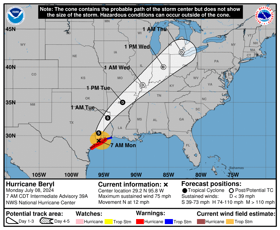
➤ Tropical Depression Beryl path
National Hurricane Center issues final advisory on Tropical Depression Beryl
The National Hurricane Center issued its final advisory on what was Tropical Depression Beryl at 5 a.m. Tuesday.
Maximum sustained winds were 30 mph as Beryl moves north at 23 mph.
The storm is expected to bring heavy rain and flash floods from the lower and mid Mississippi Valley to the Great Lakes Tuesday to Wednesday. Flood watches have been issued for:
At 5 a.m. EDT, the center of Tropical Depression Beryl was located about 95 miles north of Shreveport, Louisiana, near latitude 33.9 North, longitude 93.7 West.
The depression is moving toward the northeast near 23 mph and this motion is generally expected to continue today into tonight. Maximum sustained winds are near 30 mph, with higher gusts.
Little change in strength is forecast during the next 48 hours.
What else is NHC tracking in Atlantic basin?
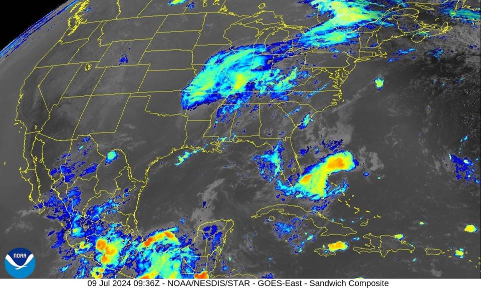
Tropical wave 1: A tropical wave in the eastern Atlantic is moving west at 11 to 17 mph.
Tropical wave 2: A tropical wave in the eastern Caribbean Sea is moving west at 11 to 17 mph.
Tropical wave 3: Another tropical wave is moving across north Central America and into the Pacific. It’s bringing scattered showers over southeast Mexico.
Who is likely to be impacted?
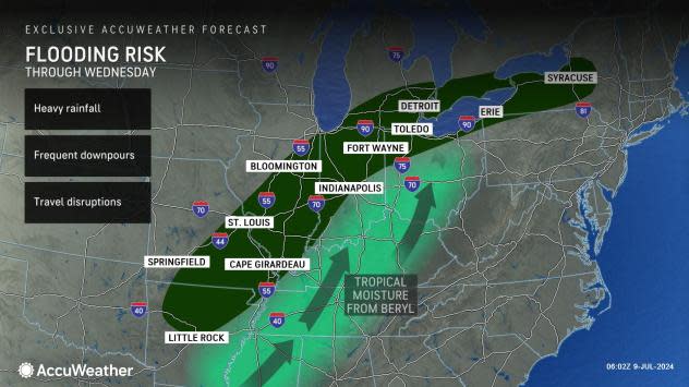
Tropical Depression Beryl: A tornado is possible through the early morning across parts of the Mid-South. A few tornadoes are possible primarily during the midday to early evening hours across southeast Missouri, northern Tennessee, Kentucky, southern Illinois, southern and central Indiana, and into southwest and central Ohio.
Heavy rainfall of 2 to 4 inches, with locally higher amounts, is expected across portions of the lower and mid Mississippi Valley into the Great Lakes today into Wednesday and over the Northeast Wednesday into Wednesday night.
Forecasters urge all residents to continue monitoring the tropics and to always be prepared. That advice is particularly important for what is expected to be a very active hurricane season.
Weather watches and warnings issued in Florida
When is the Atlantic hurricane season?
The Atlantic hurricane season runs from June 1 through Nov. 30.
When is the peak of hurricane season?
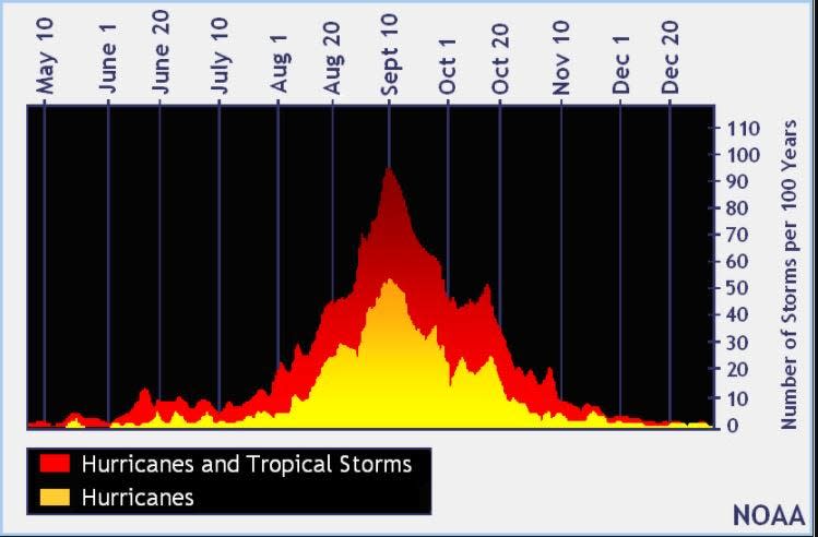
The peak of the season is Sept. 10, with the most activity happening between mid-August and mid-October, according to the Hurricane Center.
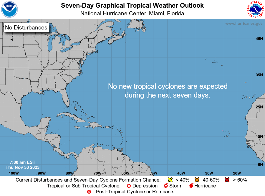
National Hurricane Center map: What are forecasters watching now?
Systems currently being monitored by the National Hurricane Center include:
Interactive map: Hurricanes, tropical storms that have passed near your city
Excessive rainfall forecast
What’s next?
We will continue to update our tropical weather coverage daily. Download your local site’s app to ensure you’re always connected to the news. And look for our special subscription offers here.
This article originally appeared on Treasure Coast Newspapers: NHC tracking Tropical Depression Beryl, 3 tropical waves. See damage
EMEA Tribune is not involved in this news article, it is taken from our partners and or from the News Agencies. Copyright and Credit go to the News Agencies, email news@emeatribune.com Follow our WhatsApp verified Channel


