Oregonians who live in the state’s highest-risk wildfire zones will be subject to stricter building codes and requirements under a new hazard map released Tuesday by state fire officials.
The yearslong process to produce a map that designates every part of Oregon as low, moderate or high risk of wildfires came about following the historic 2020 Labor Day wildfires that killed nine and destroyed thousands of homes.
All 1.9 million tax lots statewide were assessed, and of those, roughly 106,000, or 6% of the state, will be subject to rules that require creating defensible space or using fire-resistant building materials due to a high wildfire risk and location within the wildland-urban interface.
Advertisement
Advertisement
The highest concentration of high risk wildfire zones are located in Oregon’s southwest, central and eastern areas, according to the map.

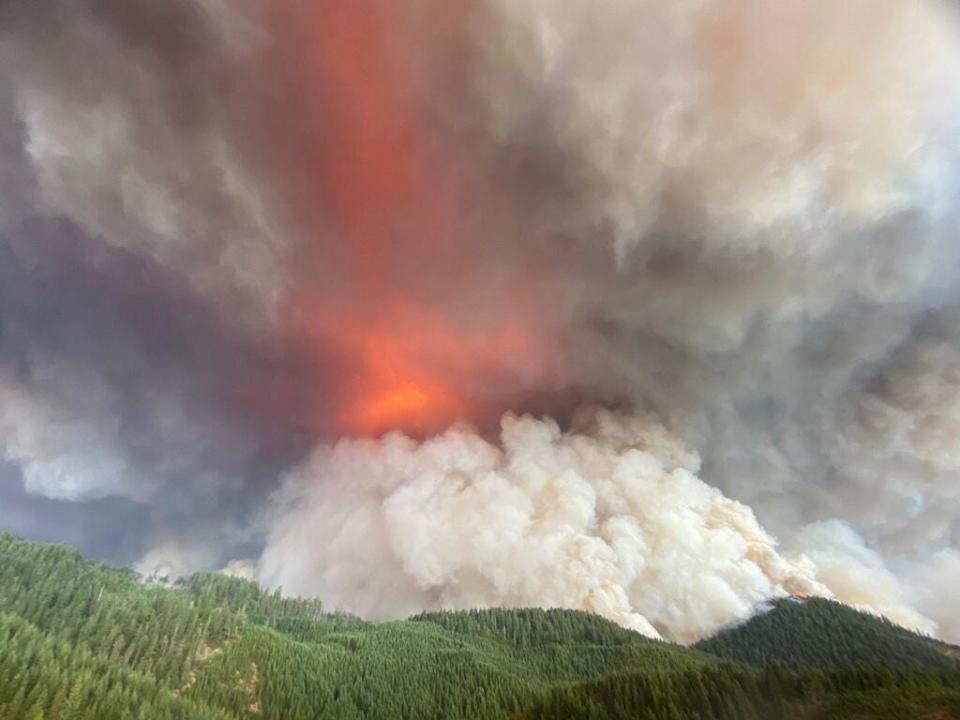
The Archie Creek Fire throws up a major smoke column northeast of Roseburg on Sept. 11, 2020.
In northwest Oregon, most of the Willamette Valley is classified as low risk while the edges of the valley and Coast Range mountains to the coast are largely moderate risk. The more forested Cascade Foothills and up to the Cascade Range give way to high risk — an area that’s historically had more frequent wildfire.

A wildfire risk map issued by the Oregon Department of Forestry and Oregon State University breaks the state up into areas with low, moderate and high risk of wildfire.
An interactive view of the map can be found at tinyurl.com/379ntaf5.
Who is subject to the new rules?
Each of the 106,000 properties subject to the new wildfire rules will be contacted by the Oregon Department of Forestry to explain the process and allow for an appeal, officials said in a news release.
Advertisement
Advertisement
In general, it would include areas mostly in Josephine and Jackson counties, outside Grants Pass and Medford, in addition to Deschutes County outside of Bend, along with other areas scattered outside of cities in eastern Oregon.
Mostly, it would require using fire-resistant building materials — often known as “home hardening” — and creating defensible space standards, which typically means removing flammable material from around homes.
“It’s a hefty packet of information that property owners will receive by certified mail,” said Tim Holschbach, Wildfire Hazard Map Lay Representative. “However, we want to ensure Oregonians get all the relevant information they need on their wildfire hazard exposure.”
What determines the hazard rating?
The map’s hazard ratings are based on weather, climate, topography and vegetation on a broad environmental scale.
Advertisement
Advertisement
More in U.S.
“The wildfire hazard map is informed by decades of research on the nature of wildfire, where it begins, why it exists, and what the challenges are,” said OSU College of Forestry wildfire scientist Andy McEvoy. “The wildfire hazard map is intended to provide property owners and policymakers with an objective foundation for making decisions.”
The map can’t zero down to the details of an individual property. However, “if a property owner has implemented appropriate defensible space already, there is likely nothing that a designation of high hazard and being within the wildland-urban interface will require of them when future code requirements are adopted,” a news release said.
Insurance companies barred from using maps to determine rates
Oregon officials stressed that passage of legislation in 2023 “prohibits insurers in Oregon from using this map, or any statewide map, for making decisions on whether to extend coverage or determine rates,” a news release said.
What’s the purpose of the maps?
The maps were developed by Oregon State University and ODF with three primary goals:
Advertisement
Advertisement
-
Educate Oregon residents and property owners about the level of hazard where they live.
-
Assist in prioritizing fire adaptation and mitigation resources for the most vulnerable locations.
-
Identify where defensible space standards and home hardening codes will apply.
A property owner’s report is available for every Oregon tax lot and includes information about hazards and resources, a news release said.
Original map recalled
The road to the current map has been years in the making. After the initial wildfire map was released in summer of 2022, it was recalled after major outcry from local residents and lawmakers.
ODF and OSU then spent another two years taking and analyzing feedback to improve the product available today, including a recent public comment period.
Oregon wildfire issue only getting worse
The size and number of wildfire burning across Oregon each summer has grown steadily, particularly since around 2012 and especially since 2017.
Advertisement
Advertisement
Last year Oregon set a record for acres burned at just under 2 million acres, mostly in the grasslands of eastern Oregon. The 2020 Labor Day Fires blowup was the most destructive in state history in terms of property damage.
But even the average years are now striking, as the state has burned 640,000 acres per season for the past 10 years, compared to an average of 198,000 acres per year from 1992 to 2001, according to the Northwest Coordination Center.
“This state has to reckon with its new reality,” Kyle Williams, ODF deputy director of fire operations, told lawmakers earlier this year.
Zach Urness has been an outdoors reporter in Oregon for 16 years and is host of the Explore Oregon Podcast. He can be reached at zurness@StatesmanJournal.com or (503) 399-6801. Find him on X at @ZachsORoutdoors.
This article originally appeared on Salem Statesman Journal: New Oregon wildfire risk maps show which areas most likely to burn
EMEA Tribune is not involved in this news article, it is taken from our partners and or from the News Agencies. Copyright and Credit go to the News Agencies, email news@emeatribune.com Follow our WhatsApp verified Channel


