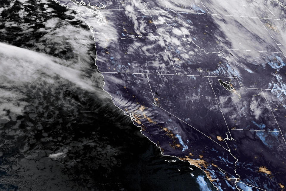
Severe weather is set to hit opposite ends of the country this week, with a powerful low pressure system — followed by an atmospheric river — set to bring damaging winds, heavy rain and snow to the Pacific Northwest, while storms and possible flooding are headed for the Gulf Coast.
The National Weather Service said in a 3 a.m. ET update that a “rapidly strengthening and extremely powerful” weather system could bring winds of 70 mph across northern California and parts of Washington and Oregon from Tuesday.
“These winds are likely to produce numerous power outages and tree damage in the most impact regions,” the weather service said.
Advertisement
Advertisement
Flood watches were issued in the northern and central Sacramento Valley, Shasta County and western Colusa County from Tuesday morning through to Saturday.
Parts of California reached freezing temperatures Monday, with 25 degrees Fahrenheit recorded in Paso Robles.
A powerful storm system will continue to bring heavy mountain snow, rain, and high winds to the Pacific Northwest and northern California through midweek.
Heavy rain and flash flooding potential exists across the central Gulf Coast over the next few days, including the Florida… pic.twitter.com/5ZbCE7zVTl
— National Weather Service (@NWS) November 19, 2024
An atmospheric river — a flowing narrow corridor of moisture that can bring severe weather — was set to hit California’s Redwood Coast and northern mountain ranges on Wednesday, bringing the threat of 5 to more than 10 inches of rain, floods and mudslides, with the threat peaking on Thursday.

Satellite images show a weather system approaching the Pacific Northwest on Tuesday morning.
The NWS urged people in affected areas to follow local news and alerts and not to travel through hazardous conditions.
Advertisement
Advertisement
“This is going to be a big one,” NBC meteorologist Angie Lassman told “Early TODAY” Tuesday morning.
6:30pm ET 11/18: Locally heavy rainfall could result in pockets of flash flooding Tue-Wed in the FL Panhandle and southeast AL. 🌧️
Most likely totals in these spots: 2-3.5 inches
But, there’s a 20-40% chance of more than 4″, which could cause flash flooding.#ALwx #FLwx #GAwx pic.twitter.com/lEwJ5Em9fU— NWS Tallahassee (@NWSTallahassee) November 18, 2024
Further south, the eastern and central Gulf Coast is due to receive heavy rain and possible flash floods, with eastern Louisiana to the western Florida Panhandle the area most at risk, the NWS said.
Elsewhere, a deep low pressure system will bring moderate to heavy rain across the Plains region, with a marginal risk of severe thunderstorms.
This article was originally published on NBCNews.com
EMEA Tribune is not involved in this news article, it is taken from our partners and or from the News Agencies. Copyright and Credit go to the News Agencies, email news@emeatribune.com Follow our WhatsApp verified Channel


