Hurricane Milton is gaining speed as a category four storm as it moves closer to Florida.
The National Weather Service warns that this could be the worst storm to impact Tampa in over 100 years.
10/07/24 11am Major Hurricane Milton Update⚠️Now a Category 5 Hurricane⚠️If the storm stays on the current track, it will be the worst storm to impact the Tampa area in over 100 years. ⚠️Please evacuate if told to do so. ⚠️Complete all prep before tomorrow night. #flwx pic.twitter.com/Cq9tJsfr2A
— NWS Tampa Bay (@NWSTampaBay) October 7, 2024
Hurricane specialist and storm surge expert Michael Lowry warns, “Milton bears all the hallmarks of the most impactful and consequential hurricanes in American history.”
Milton bears all the hallmarks of the most impactful and consequential hurricanes in American history. Catastrophic storm surge will rival century-old records along Florida’s west coast, with major inland flooding an increasing concern. The very latest ⬇️https://t.co/BOf8lgUIf1 pic.twitter.com/h6iQ7xEa3t
— Michael Lowry (@MichaelRLowry) October 8, 2024
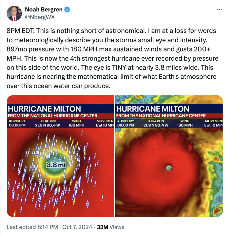
Yesterday, the storm reached record-breaking category five status, and meteorologist Noah Bergren put the strength of Milton into perspective:

Yes, he really did say, “This hurricane is nearing the mathematical limit of what Earth’s atmosphere over this ocean water can produce.”

People are obviously shocked by this “mathematical limit” line.
“Seeing a veteran meteorologist use the phrase ‘mathematical limit’ terrifies me. Please stay safe out there, everyone,” this person said.
“Meteorologists are running out of adjectives to describe how powerful Hurricane Milton is getting,” another person said.
And for those of you wondering what exactly that “mathematical limit” line means, here’s what Noah Bergren said on Facebook about it:

Milton is expected to make landfall somewhere in Florida on Wednesday night. Hurricane specialist John Morales says, “An expanding wind field, the angle of approach to the coast, and the formidable strength, all will lead to a deep & damaging surge in Florida.”
Tuesday begins with #Milton having completed it’s eyewall replacement cycle. The new eye is clearing out and the wind field has expanded. An expanding wind field, the angle of approach to the coast, and the formidable strength, all will lead to a deep & damaging surge in #Florida pic.twitter.com/hfNzf2vUUr
— John Morales (@JohnMoralesTV) October 8, 2024
Make sure you follow the National Weather Service for updates about the storm.
EMEA Tribune is not involved in this news article, it is taken from our partners and or from the News Agencies. Copyright and Credit go to the News Agencies, email news@emeatribune.com Follow our WhatsApp verified Channel


