ST. LOUIS – Temperatures have been slowly dropping over the last few weeks, which means the area could have the possibility of seeing snowflakes in the air sooner than later.
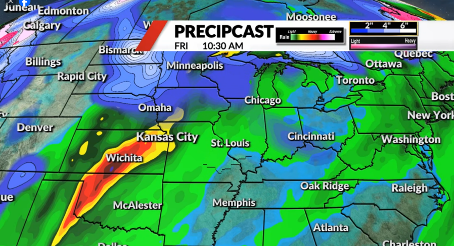
Although temperatures will climb this weekend, a burst of cold air will reach St. Louis in the middle of next week, shifting to more typical November weather.

Next Thursday will bring a high temperature of 45 degrees. As snow moves through the northern states and Iowa, it grants the possibility of flurries throughout Thursday late and early Friday.
Advertisement
Advertisement
However, FOX 2 meteorologist John Fuller says right now, the modeling remains inconsistent as it is still a week away.
The first snowfall has ranged over the past few years, bringing inconsistent times and amounts of snow to the area:
-
2022-2023: Nov. 15 (.8 inch)
-
2021-2022: Jan. 2 (.1 inch)
-
2020-2021: Dec. 16 (.3 inch)
-
2019-2020: Nov. 11 (1.5 inches)
-
2018-2019: Nov. 12 (1.2 inches)
On average, measurable snowfall and timing for St. Louis is .1 inch or more around Dec. 4.
Copyright 2024 Nexstar Media, Inc. All rights reserved. This material may not be published, broadcast, rewritten, or redistributed.
For the latest news, weather, sports, and streaming video, head to FOX 2.
EMEA Tribune is not involved in this news article, it is taken from our partners and or from the News Agencies. Copyright and Credit go to the News Agencies, email news@emeatribune.com Follow our WhatsApp verified Channel


