


(KLFY) — The National Hurricane Center continues to track a tropical wave moving through the Caribbean Sea and a second wave in the eastern Atlantic Ocean.
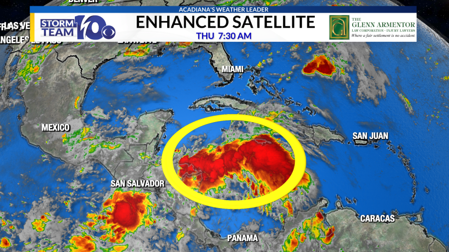
Showers and thunderstorm activity associated with the wave in the Caribbean Sea remains disorganized this morning. Tropical formation is not expected in the near term as this wave progresses westward.
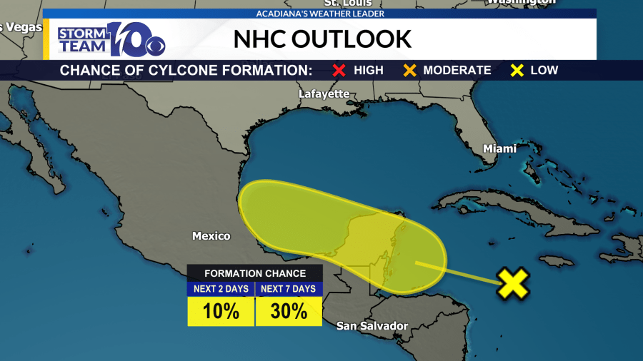
There is a low chance of a tropical depression or stronger forming in the next 3 to 5 days as this wave moves into the Bay of Campeche.
Any system that could form would stay well south of Louisiana and keep impacts minimal to the U.S. Gulf Coast.
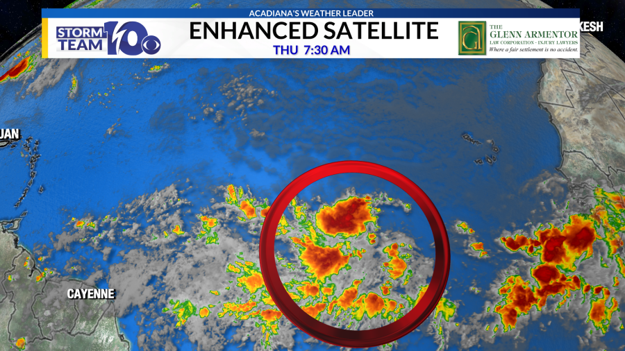
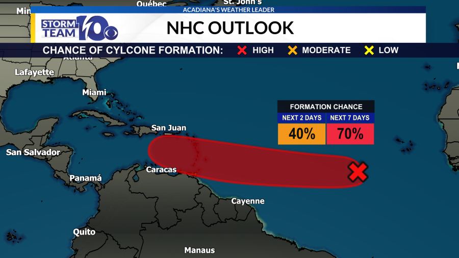
Also, the NHC is monitoring a more robust tropical wave in the eastern Atlantic Ocean. This wave has a 70% chance for tropical development in the next 7 days as it moves westward towards the Caribbean Sea.
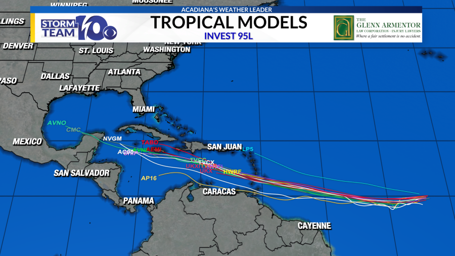

The Atlantic tropical wave has been designated as “Invest 95-L”. Tropical models are consistent with a westward track into Caribbean Sea next week where further organization is expected. It is far too early to know if any impacts will happen across the U.S. or Gulf Coast but this disturbance will have our full attention through its lifespan.
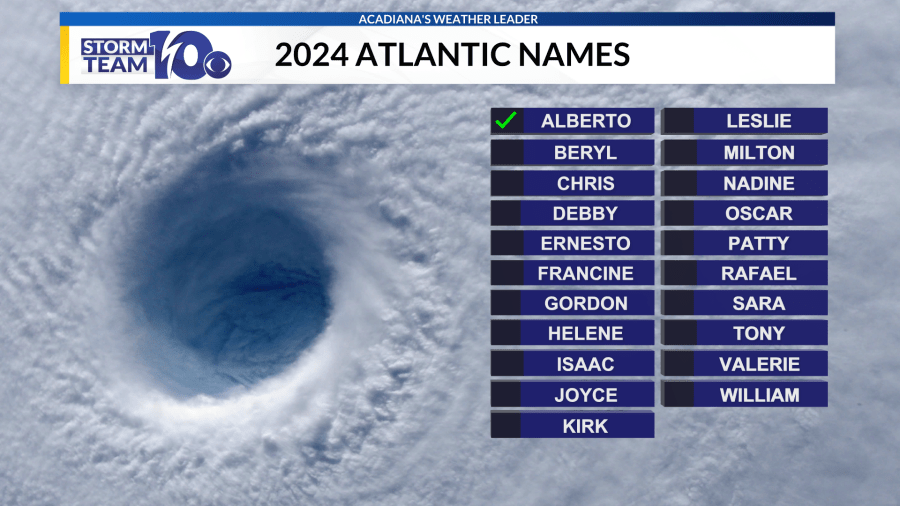
The next names on the list are Beryl and Chris.
Thanks for signing up!
Watch for us in your inbox.
Subscribe Now
Latest news
Watch Live: Trump and Biden to face off in presidential debate rematch
Oklahoma executes man convicted of killing 7-year-old former stepdaughter
Senate Democrats baffled by Trump lowering Biden debate expectations
Copyright 2024 Nexstar Media, Inc. All rights reserved. This material may not be published, broadcast, rewritten, or redistributed.
For the latest news, weather, sports, and streaming video, head to KLFY.com.
EMEA Tribune is not involved in this news article, it is taken from our partners and or from the News Agencies. Copyright and Credit go to the News Agencies, email news@emeatribune.com Follow our WhatsApp verified Channel


