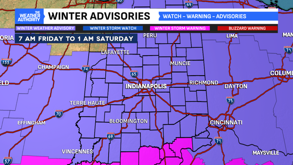
We’re bookending this week with snow showers. After a snowy start to the week with some areas seeing a foot of snow, we’re going to tack onto our snow pack as we close the week. Central Indiana is under a Winter Weather Advisory from 7 a.m. Friday until 1 a.m. Saturday.

Snow will move into the state over the morning hours and likely arrive in the Indianapolis area closer to 10 a.m. Snow will continue to spread east and by the early afternoon, everyone will have seen snow. It will be the afternoon and early evening hours seeing the greatest impacts from this system. This is when most of our accumulation will occur. Expect a slow and slick evening commute.
Widespread snow totals of 2″ to 4″ are likely with some isolated pockets totaling 5″. While these totals are much lighter than what we had earlier in the week, this is still plenty to create some big problems on the roadways.

We turn quiet over the weekend with some flurries or passing snow showers at times. We have spent over a week with temperatures below freezing. We fell below freezing a little before 4 a.m. last Friday and are still there. We have a shot to crack the freezing mark Sunday, but it will be close. We’re forecasting a high temperature of 33°. Another shot of arctic air is set to settle in the state early next week.

Copyright 2025 Nexstar Media, Inc. All rights reserved. This material may not be published, broadcast, rewritten, or redistributed.
For the latest news, weather, sports, and streaming video, head to WTTV CBS4Indy.
EMEA Tribune is not involved in this news article, it is taken from our partners and or from the News Agencies. Copyright and Credit go to the News Agencies, email news@emeatribune.com Follow our WhatsApp verified Channel


