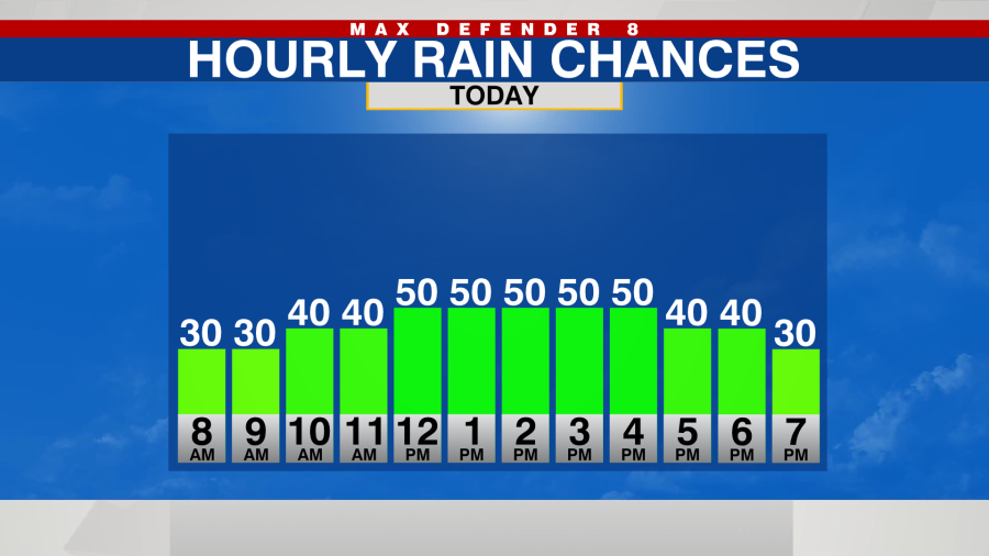
TAMPA, Fla. (WFLA) – With winds still coming from the Gulf of Mexico, a few showers get pushed onshore this morning. Rain chances increase through the middle of the afternoon. These showers move quickly to the east and taper off in the early evening.
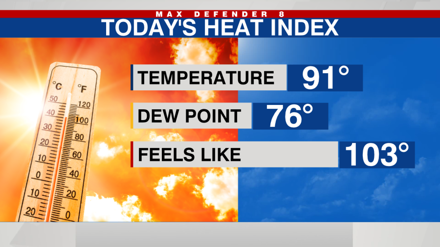
We are still feeling the extra humidity with the onshore wind as well. Highs will be in the low 90s, but it’ll feel like 100-105 again.
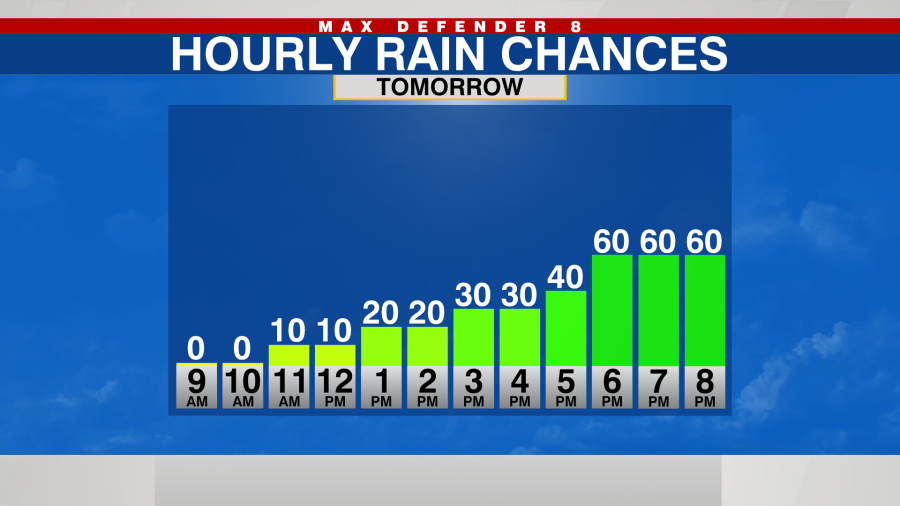
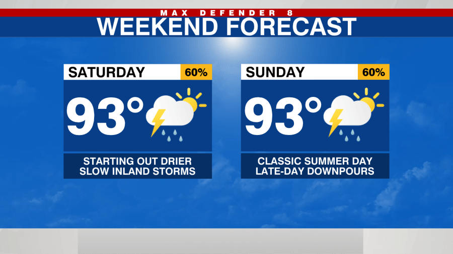
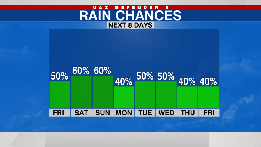
The pattern reverses this weekend, and winds start coming from the southeast. That creates drier mornings and hot afternoons. Highs reach the low-mid 90s this weekend.
The first showers develop Saturday around midday, but widespread heavy storms are expected in the center of the state by the late afternoon. Some of the rain drifts back toward the Gulf of Mexico after sunset.
It’s similar for Sunday with late-day downpours pushing toward the Gulf.
We continue the more classic summer weather pattern of morning sunshine and late-day storms for most of next week.
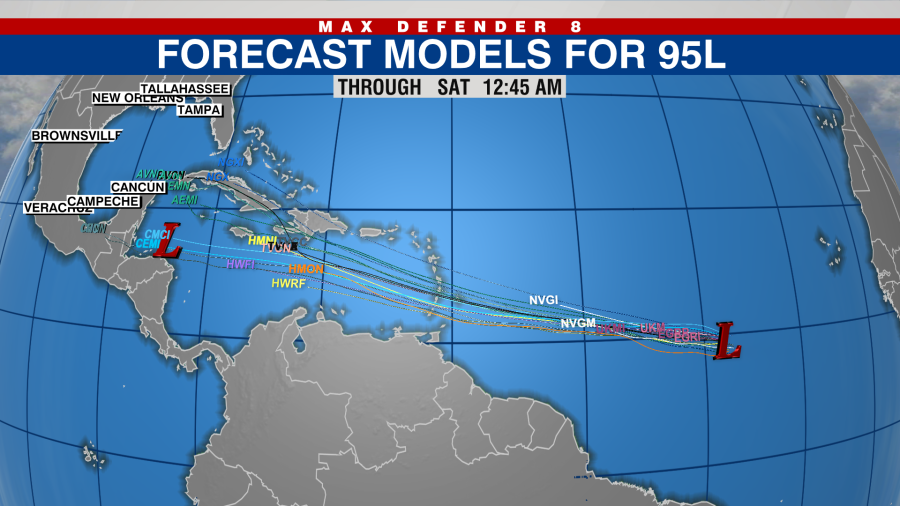
In the tropics, there’s one tropical wave that will likely become our next tropical storm. The next name on the list is Beryl. This tropical wave in the eastern Atlantic should head due west into the Caribbean by early next week.
Thanks for signing up!
Watch for us in your inbox.
Subscribe Now
Copyright 2024 Nexstar Media, Inc. All rights reserved. This material may not be published, broadcast, rewritten, or redistributed.
For the latest news, weather, sports, and streaming video, head to WFLA.
EMEA Tribune is not involved in this news article, it is taken from our partners and or from the News Agencies. Copyright and Credit go to the News Agencies, email news@emeatribune.com Follow our WhatsApp verified Channel