


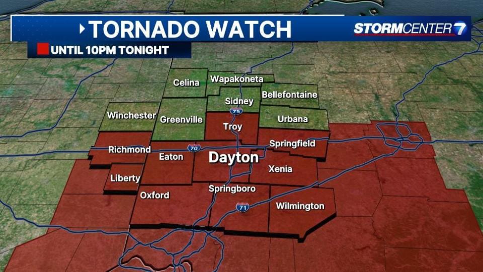
A Tornado Watch has been issued for Butler, Clark, Clinton, Greene, Montgomery, Miami, Preble, and Warren counties and Wayne County, Indiana until 10 p.m.
A Severe Thunderstorm Warning has been issued for Darke, Miami, Shelby and Preble counties in Ohio and Wayne County, Indiana until 6:45 p.m.
A Severe Thunderstorm Warning has been issued for Butler County until 6:30 p.m.
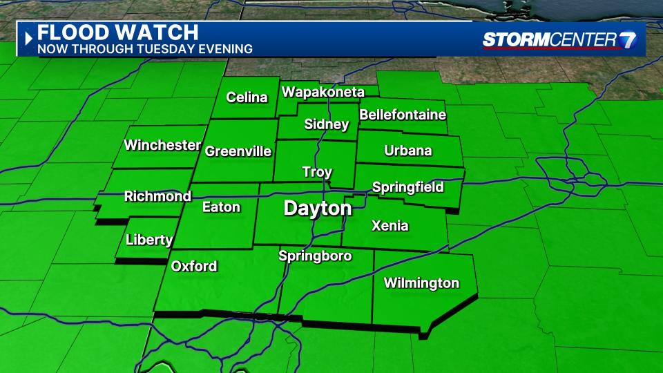
A Flood Watch is in effect for the entire region now until 11 p.m. tonight.
A Flood Advisory has been issued for Auglaize, Darke, Logan, Mercer, and Shelby counties until 8:30 p.m.
A Flood Advisory has been issued for Randolph County, Indiana until 8:15 p.m.
A Flood Warning has been issued until Thursday morning for the Great Miami River in Sidney.
A Flood Warning has been issued until 2 p.m. on Thursday for the Great Miami River in Troy.
A Flood Warning has been issued until 2:36 a.m. for the Mad River in Springfield.
Storms with a history of severe warnings are now entering the Miami Valley. Storm Center 7 Chief Meteorologist Austin Chaney checks the latest conditions and hazards live on News Center 7 at 6:00.
QUICK-LOOK FORECAST:
Severe weather risk continues this evening
Flooding risk remains through tonight
Colder air, some snow showers next two days
>> TRACK THE LATEST CONDITIONS: Live Doppler 7 Radar
DETAILED FORECAST:
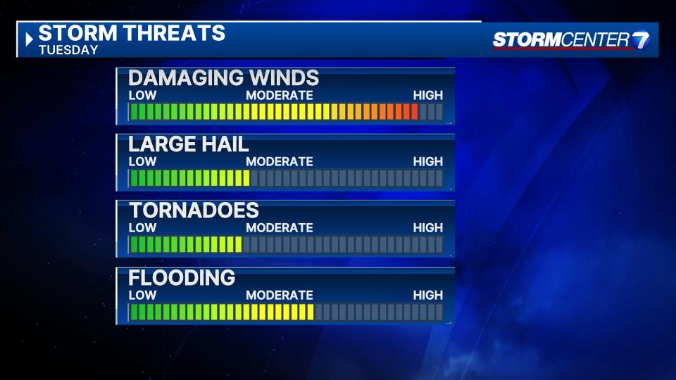
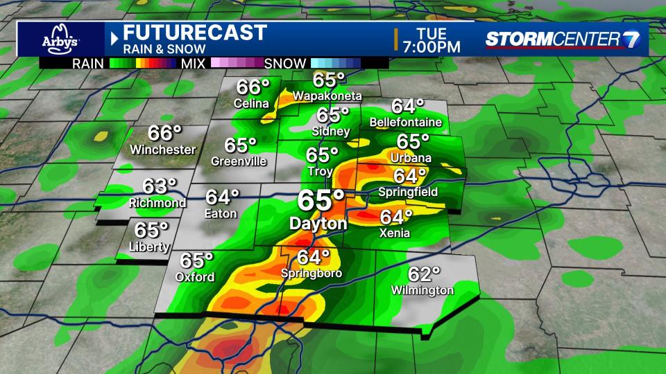
TUESDAY: We still face a significant severe weather risk this evening. The Storm Prediction Center continues to give much of the Miami Valley a level 4/5 risk for severe storms, with a level 3/5 risk highlighted over northwestern portions of the Valley. Either way, damaging winds, hail, and tornadoes are all possible. The severe weather threat should wind down after 8PM leaving cloudy skies and colder air in its wake.

WEDNESDAY: Windy and much colder with rain showers mixing with snow showers. Highs in the middle 40s.
THURSDAY: Lingering rain or snow showers continuing. Staying cloudy. Chilly with highs in the low 40s.
FRIDAY: Mostly cloudy with a sprinkle possible. Still cool with highs in the middle 40s.
SATURDAY: Sunshine and a bit milder with higher in the middle 50s.
SUNDAY: (ECLIPSE EVE!) Partly cloudy and milder with highs in the upper 50s.
MONDAY: (TOTAL SOLAR ECLIPSE) Mostly cloudy with a chance for rain showers. Highs in the middle 60s.
TUESDAY: Partly cloudy and mild with highs in the mid 60s.
EMEA Tribune is not involved in this news article, it is taken from our partners and or from the News Agencies. Copyright and Credit go to the News Agencies, email news@emeatribune.com Follow our WhatsApp verified Channel


