A mini heatwave is set to his Britain this weekend as temperatures could peak at 21C. Dry spells and sunshine have been predicted by the Met Office as we get a taste of warmer days.
Last weekend, temperatures peaked for the first time in 2024 as parts of the UK enjoyed their first glimpse of summer. However an African plume could make push temperatures even higher as it makes its way over the to the region, reports DailyExpress.
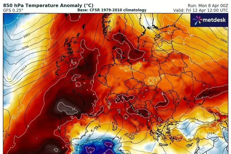
Parts of the UK can expect highs of 21C this Saturday, April 13, weather maps show. Meanwhile there will be highs of 20C on Friday, when Brits wind down for the weekend.
READ MORE: Prince Harry eager for meeting with Prince William as he plans UK return
Get breaking news on BirminghamLive WhatsApp, click the link to join
The Midlands is expecting to see highs of 19C. Meanwhile temperatures will peak at around 18C on Friday in Manchester and northern England. But London is set to see the highest temperatures. Scotland can expect highs of 15C.
The Met Office said the temperatures will “be above normal” for this time of year, but will be welcomed after Storm Kathleen saw 70mph gusts over the weekend. Despite the warm temperatures, the Met Office warned of “changeable spells” – including rain and showers that could hit western and northwestern parts of the UK.
But thankfully this weekend will be dry for most, though cloudy conditions are expected on Saturday. Friday will see the most sunshine in places, with temperatures dropping down to 16C from Sunday.
Netweather’s long-range forecast going up to the end of April added that the back end of April or early May could have warmer weather and could be less wet than normal. It added that “substantial warmth via southerly winds” could drive average temperatures up by one or two degrees.
Netweather’s outlook for a large part of April remains relatively mixed, with even some thin layers of snow potentially arriving in some areas. From April 15 it says: “This week will have low pressure centred mostly to the north and north-east of Britain, with high pressure centred to the south of Britain and in the mid-North Atlantic.
“As a result, the weather will be predominantly dry and settled in the south, but somewhat more changeable in the north, especially in northern Scotland. Winds will mostly be westerly, but there will be a northerly blast at the start of the week, which has potential to bring some sleet and snow showers to low levels for a time in the north.”
But this won’t be long-lived. Netweather forecasters added: “There is potential for one or two short-lived northerlies during the rest of the week, these most likely to affect the north of Britain, but as the week progresses, northerlies will become less likely, as the high pressure area will tend to push slowly eastwards with time.”
EMEA Tribune is not involved in this news article, it is taken from our partners and or from the News Agencies. Copyright and Credit go to the News Agencies, email news@emeatribune.com Follow our WhatsApp verified Channel