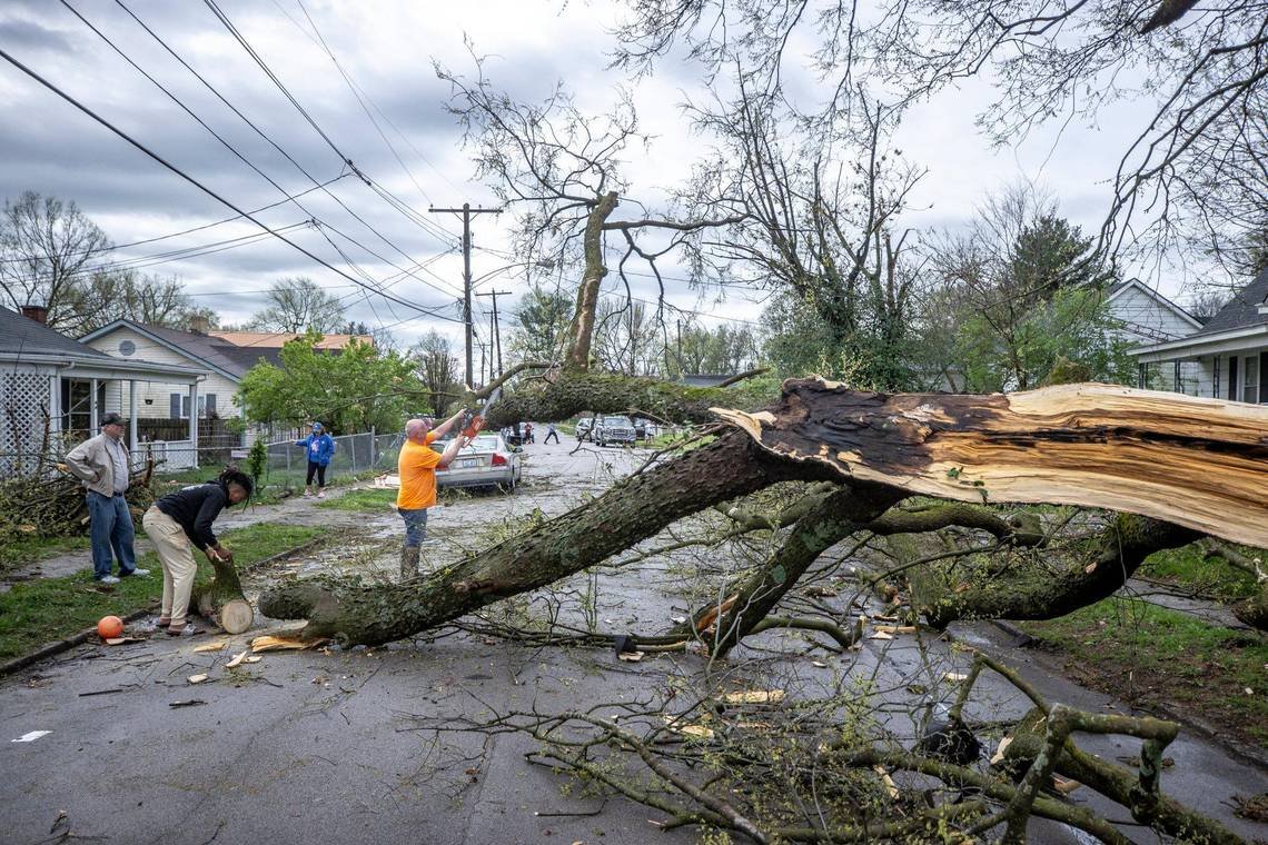

A strong thunderstorm has downed trees and powerlines, blocked roads and left thousands of Lexington and Central Kentucky residents without power Tuesday.
Given the National Weather Service has warned the storms’ strongest impact could still be on its way, arriving between 2 and 10 p.m. Tuesday, authorities are urging people to stay weather aware. Damaging winds, hail and tornadoes are all possible throughout the region, the NWS office in Louisville said Tuesday.
Part of staying safe during severe weather means understanding some key terms meteorologists use in their forecasts. Here’s a quick guide to the most essential, including understanding the difference between tornado watches and warnings, which could save your life.
As a reminder, you can sign up to receive text message alerts from Kentucky’s Emergency Management agency by texting “follow kyempio” to 40404. You can also follow the NWS in Louisville on Facebook or X, formerly Twitter.
What is a severe thunderstorm?
As defined by the NWS, a severe thunderstorm is one that produces a tornado, winds of at least 58 miles per hour or hail at least 1 inch in diameter.
At 9:15 a.m. Tuesday, the NWS service issued a severe thunderstorm warning for Fayette County when it picked up a storm moving east from Dunbar High School to Nicholasville at 50 mph. Wind gusts of up to 60 mph were also possible. That advisory expired at 10:15 a.m.
According to the NWS, “the best defense against thunderstorms is to stay inside a sturdy building or shelter that can protect you from deadly lightning, large hail, damaging winds, flooding rain and tornadoes. Fortunately, thunderstorms typically do not last very long and will most often pass by your location in less than one hour.”
What is the relationship between tornadoes and supercells?
Tornadoes are known to occur in a particular kind of severe thunderstorm called a supercell. According to the weather service, these supercells are defined by consistent, rotating updrafts, which are crucial to tornado formation.
The presence of a mesocyclone within a supercell thunderstorm means there’s a high potential for tornadoes to develop.
Severe weather watches, warnings and advisories
The NWS uses the term “watch” when the risk of hazardous weather or an event has increased significantly, but its occurrence, location and/or timing remains uncertain.
“It is intended to provide enough lead time so that those who need to set their plans in motion can do so,” the agency’s glossary states.
A severe weather warning is more serious than a watch. It signals dangerous weather is happening, is on its way or has a high chance of occurring. The NWS states, “a warning is used for conditions posing a threat to life or property.”
If a severe weather warning has been issued for your area, you should seek shelter in a strong building immediately.
Advisories, meanwhile, require the lowest level of caution, but you should still be mindful and take steps to remain safe. The NWS issues advisories when “weather conditions that are less serious than a warning. They are for events that may cause significant inconvenience, and if caution is not exercised, it could lead to situations that may threaten life and/or property.”
What does a shelter in place order mean?
Though not necessarily a weather-related term, a warning urging you to shelter in place means people should go inside, close any windows and doors, turn off air conditioning and heating systems and turn on the radio or TV for more information.
In contrast, officials may urge or order those in the public to evacuate or leave the area. An evacuation warning means you should begin preparing to leave, and an evacuation order means a threat to your life is imminent and you need to leave right away.
Other important weather terms to know
Tornadoes: The NWS defines this as a violently rotating column of air, usually suspended from a cumulonimbus cloud, with circulation that reaches the ground. “It nearly always starts as a funnel cloud and may be accompanied by a loud roaring noise. On a local scale, it is the most destructive of all atmospheric phenomena.”
Flash floods: As explained by the NWS, a flash flood is the rapid and extreme flow of high water into an area. Ongoing flooding can escalate into flash flooding when intense rainfall results in a rapid surge of rising flood waters.
Hail: Hail is a showery precipitation in the form of irregular pellets or balls of ice. Hailstones can range in size from pea-sized (0.25 inches) to softball-sized (4.5 inches).
Cold front: A cold front is a zone separating two air masses, of which the cooler, denser air mass advances and forces the warmer air mass to quickly rise. Cold fronts can introduce instability into a weather system and are connected to the formation of the cumulonimbus clouds associated with thunderstorms.
Do you have a question about severe weather in Kentucky for our service journalism team? Let us know. Send us an email at ask@herald-leader.com or submit your questions and comments with the Know Your Kentucky form below.
EMEA Tribune is not involved in this news article, it is taken from our partners and or from the News Agencies. Copyright and Credit go to the News Agencies, email news@emeatribune.com Follow our WhatsApp verified Channel