A second ‘mini-heatwave’ is set to bring prolonged dry spell, the Met Office predicts. Brits can look forward to a second ‘mini-heatwave’, with the Met Office suggesting it could usher in a “prolonged dry spell” of weather.
Currently basking in an “African plume”, the nation has seen temperatures soar following weeks of wet and windy conditions. Norfolk enjoyed highs of 20C on Thursday, and London might see the mercury rise to 21C today.
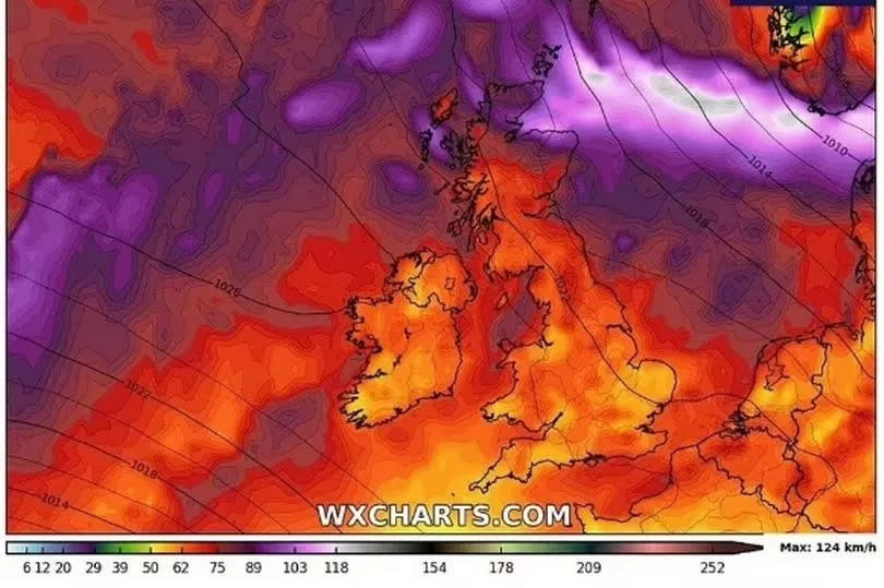
The warmth is widespread, with Aberdeen expecting 18C a significant 7C above the average for this time of year.
Read more: Coventry nightclub opens huge new roof terrace after years of delays
The warmth is widespread, with Aberdeen expecting 18C a significant 7C above the average for this time of year.
Although a dip in temperatures is forecast for Sunday, another bout of warm weather is on the horizon as high pressure is set to dominate by the next weekend. Met Office forecaster Alex Burkill anticipates Saturday, April 20, to be the turning point, stating: “There is a fairly good chance that we could see high pressure dominating across the whole of the country and that means it is going to turn markedly drier than it has been.”, reports the Mirror.
He added, “Not necessarily sunny, there could be quite a bit of cloud around but it does look like we are going to see a more prolonged dry spell than we have seen through many recent weeks and months to be honest.”
Weather maps from WXCharts corroborate this, showing swathes of dark red indicating hotter conditions ahead. Cities including Birmingham, Manchester, London, and Plymouth may experience temperatures around 20C.
The start of next week will see a significant drop in temperatures, with the possibility of numerous showers on Tuesday before the high pressure system begins to dominate. “We are going to see some colder air plunging its way in as we go into the beginning of next week so things are going to turn markedly cooler,” Mr Burkill elaborated.
He further explained, “What happens there after, well the low pressure system that is affecting us through the latter part of the weekend and the start of next week, by the time we get to Tuesday, that is going to have shifted away towards Scandinavia and then we see high pressure building from the west.”
“So Tuesday is something of a transition day in the sense that there will still be some showery rain around and we will end up with a bit of a northerly flow so quite a bit of a cold direction, so quite a chilly day on Tuesday with some showery rain around. But if we skip forward a couple of days and by Thursday we are likely to have high pressure pushing its way in, becoming a bit more dominant across the western parts of the UK, perhaps still some rain around towards the north, but turning drier.”
In their latest forecast, The Met Office stated that from April 16 to 25: “Winds from the north or northwest are expected to affect the UK at the start of this period. This brings showers or some longer spells of rain, these most frequent across the north and northwest. Some heavy rain is possible at times with a risk of snow over high ground. However, further south conditions will be drier and brighter. Temperatures will mostly be below normal. Through the rest of this period a build of pressure will probably occur meaning more in the way of dry weather, especially in the south and east. Some rain is still possible at times, mainly in the northwest. Temperatures will probably return to closer to normal, perhaps slightly above in places.”
Sign up for our FREE daily newsletter here for all the latest news about Coventry.
EMEA Tribune is not involved in this news article, it is taken from our partners and or from the News Agencies. Copyright and Credit go to the News Agencies, email [email protected] Follow our WhatsApp verified Channel